
Thank you for supporting this site ❤️
Make a donation
Make a donation
Rutledge topographic map
Click on the map to display elevation.
Thank you for supporting this site ❤️
Make a donation
Make a donation
About this map
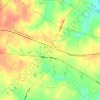
Name: Rutledge topographic map, elevation, terrain.
Location: Rutledge, Morgan County, Georgia, United States (33.60841 -83.62929 33.64157 -83.59145)
Average elevation: 211 m
Minimum elevation: 180 m
Maximum elevation: 233 m
Thank you for supporting this site ❤️
Make a donation
Make a donation
Other topographic maps
Click on a map to view its topography, its elevation and its terrain.