
Cameron topographic map
Click on the map to display elevation.
About this map
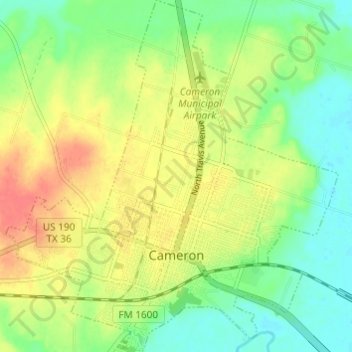
Name: Cameron topographic map, elevation, terrain.
Location: Cameron, Milam County, Texas, 76520, United States (30.83893 -97.00638 30.89101 -96.94896)
Average elevation: 116 m
Minimum elevation: 92 m
Maximum elevation: 146 m
Other topographic maps
Click on a map to view its topography, its elevation and its terrain.