
Thank you for supporting this site ❤️
Make a donation
Make a donation
Scarfskerry topographic map
Click on the map to display elevation.
Thank you for supporting this site ❤️
Make a donation
Make a donation
About this map
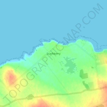
Name: Scarfskerry topographic map, elevation, terrain.
Location: Scarfskerry, Caithness, Scotland, KW14 8XN, United Kingdom (58.62880 -3.28945 58.66880 -3.24945)
Average elevation: 10 m
Minimum elevation: 0 m
Maximum elevation: 40 m
Thank you for supporting this site ❤️
Make a donation
Make a donation
Other topographic maps
Click on a map to view its topography, its elevation and its terrain.