
Ulle topographic map
Interactive map
Click on the map to display elevation.
About this map
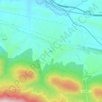
Name: Ulle topographic map, elevation, terrain.
Location: Ulle, La Jacetania, Huesca, Aragonien, 22714, Spanien (42.52145 -0.52257 42.56145 -0.48257)
Average elevation: 977 m
Minimum elevation: 821 m
Maximum elevation: 1,428 m