
红旗村 topographic map
Interactive map
Click on the map to display elevation.
About this map
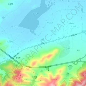
Name: 红旗村 topographic map, elevation, terrain.
Location: 红旗村, 禾甸镇, 祥云县, 大理白族自治州, 云南省, 中国 (25.52232 100.66083 25.56232 100.70083)
Average elevation: 2,015 m
Minimum elevation: 1,966 m
Maximum elevation: 2,202 m