
彭城镇 topographic map
Interactive map
Click on the map to display elevation.
About this map
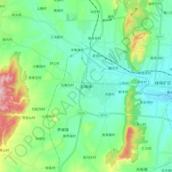
Name: 彭城镇 topographic map, elevation, terrain.
Location: 彭城镇, 邯郸市, 河北省, 056000, 中国 (36.37997 114.12254 36.45997 114.20254)
Average elevation: 198 m
Minimum elevation: 118 m
Maximum elevation: 404 m
Other topographic maps
Click on a map to view its topography, its elevation and its terrain.