
Thank you for supporting this site ❤️
Make a donation
Make a donation
Tanggetada topographic map
Click on the map to display elevation.
Thank you for supporting this site ❤️
Make a donation
Make a donation
About this map
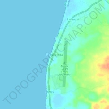
Name: Tanggetada topographic map, elevation, terrain.
Location: Tanggetada, Kolaka, Southeast Sulawesi, Sulawesi, Indonesia (-4.35420 121.50020 -4.31420 121.54020)
Average elevation: 7 m
Minimum elevation: -1 m
Maximum elevation: 41 m
Thank you for supporting this site ❤️
Make a donation
Make a donation
Other topographic maps
Click on a map to view its topography, its elevation and its terrain.