
Tasiujaq topographic map
Interactive map
Click on the map to display elevation.
About this map
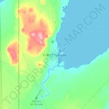
Name: Tasiujaq topographic map, elevation, terrain.
Location: Tasiujaq, Kativik, Nord-du-Québec, Québec, Canada (58.65783 -69.97181 58.73783 -69.89181)
Average elevation: 37 m
Minimum elevation: -1 m
Maximum elevation: 157 m