
Maynay topographic map
Interactive map
Click on the map to display elevation.
About this map
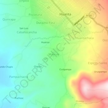
Name: Maynay topographic map, elevation, terrain.
Location: Maynay, Huanta, Ayacucho, Perú (-12.97471 -74.27229 -12.93471 -74.23229)
Average elevation: 2,577 m
Minimum elevation: 2,389 m
Maximum elevation: 2,898 m