
荔枝園 topographic map
Interactive map
Click on the map to display elevation.
About this map
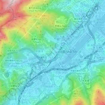
Name: 荔枝園 topographic map, elevation, terrain.
Location: 荔枝園, 銅鑼灣, 沙田區, 新界, 香港, 中国 (22.36105 114.16410 22.40105 114.20410)
Average elevation: 111 m
Minimum elevation: -4 m
Maximum elevation: 479 m