
Fort McKay topographic map
Interactive map
Click on the map to display elevation.
About this map
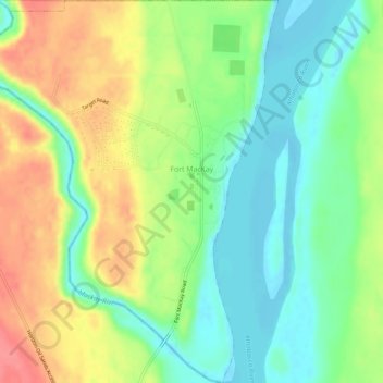
Name: Fort McKay topographic map, elevation, terrain.
Location: Fort McKay, Division No. 16, Alberta, Canada (57.16519 -111.67091 57.19620 -111.62490)
Average elevation: 259 m
Minimum elevation: 229 m
Maximum elevation: 300 m
Other topographic maps
Click on a map to view its topography, its elevation and its terrain.
Fort McMurray
Canada > Alberta > Division No. 16
Fort McMurray, Division No. 16, Alberta, Canada
Average elevation: 345 m