
Anchayaku topographic map
Interactive map
Click on the map to display elevation.
About this map
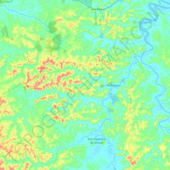
Name: Anchayaku topographic map, elevation, terrain.
Location: Anchayaku, Eloy Alfaro, Esmeraldas, Ecuador (0.85779 -79.22965 1.05370 -79.02091)
Average elevation: 44 m
Minimum elevation: -3 m
Maximum elevation: 170 m
Other topographic maps
Click on a map to view its topography, its elevation and its terrain.
La Tola
Ecuador > Esmeraldas > Eloy Alfaro > La Tola
La Tola, Eloy Alfaro, Esmeraldas, Ecuador
Average elevation: 5 m
La Concordia
Ecuador > Esmeraldas > Eloy Alfaro > Borbón > La Concordia
La Concordia, Borbón, Eloy Alfaro, Esmeraldas, Ecuador
Average elevation: 21 m
Cordillera de Toisán
Ecuador > Esmeraldas > Eloy Alfaro > Luis Vargas Torres
Cordillera de Toisán, Luis Vargas Torres, Eloy Alfaro, Esmeraldas, Ecuador
Average elevation: 1,297 m