
Vauchalupeau topographic map
Interactive map
Click on the map to display elevation.
About this map
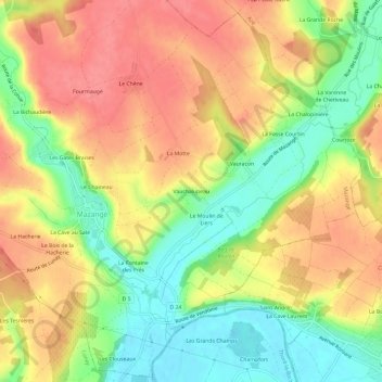
Name: Vauchalupeau topographic map, elevation, terrain.
Average elevation: 112 m
Minimum elevation: 71 m
Maximum elevation: 145 m
Other topographic maps
Click on a map to view its topography, its elevation and its terrain.
La Cohue
France > Centre-Val de Loire > Loir-et-Cher > Mazangé
La Cohue, Mazangé, Vendôme, Loir-et-Cher, Centre-Val de Loire, France métropolitaine, 41100, France
Average elevation: 130 m