
Santo Tomé topographic map
Interactive map
Click on the map to display elevation.
About this map
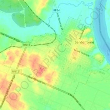
Name: Santo Tomé topographic map, elevation, terrain.
Average elevation: 72 m
Minimum elevation: 52 m
Maximum elevation: 102 m
Other topographic maps
Click on a map to view its topography, its elevation and its terrain.
Barrio San Martin
Argentina > Corrientes > Municipio de Santo Tomé
Barrio San Martin, Santo Tomé, Municipio de Santo Tomé, Departamento Santo Tomé, Corrientes, Argentina
Average elevation: 78 m