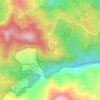
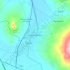
Calnali topographic map
Click on the map to display elevation.
Calnali
Central Calnali is located at 980 m elevation, and the entire municipality occupies the eastern slope of the Sierra Madre Oriental. The terrain is largely mountainous Veracruz moist forests fragmented by pasture and cropland. The Río Calnali and the Río Tula/Atempa, tributaries of the Río Conzintla and ultimately the Río Pánuco, traverse the municipality from west to east. Each of these rivers is a hybrid zone between two species of the swordtail fish Xiphophorus.
About this map

Name: Calnali topographic map, elevation, terrain.
Location: Calnali, Hidalgo, Mexico (20.83972 -98.66924 20.96893 -98.42221)
Average elevation: 868 m
Minimum elevation: 222 m
Maximum elevation: 1,779 m
Other topographic maps
Click on a map to view its topography, its elevation and its terrain.


Pachuca
Mexico > Hidalgo > Pachuca de Soto
Pachuca has a semi-arid climate (Köppen climate classification BSk). The climate is cool with high rainfall and occasional hail during the summer months and dry conditions during the winter. The coldest month is January, with an average high of 20 °C (68 °F) and an average low of 3 °C (37 °F). Winter…
Average elevation: 2,459 m
Pachuca
Mexico > Hidalgo > Pachuca de Soto
Pachuca has a semi-arid climate (Köppen climate classification BSk). The climate is cool with high rainfall and occasional hail during the summer months and dry conditions during the winter. The coldest month is January, with an average high of 20 °C (68 °F) and an average low of 3 °C (37 °F). Winter…
Average elevation: 2,459 m
Santiago Tulantepec
Mexico > Hidalgo > Santiago Tulantepec de Lugo Guerrero
Average elevation: 2,260 m

Col. Loma Bonita
Mexico > Hidalgo > Atotonilco de Tula > Atotonilco de Tula > Col. Loma Bonita
Average elevation: 2,164 m