
Ouled Dahmane topographic map
Interactive map
Click on the map to display elevation.
About this map
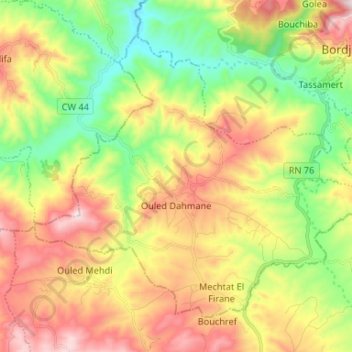
Name: Ouled Dahmane topographic map, elevation, terrain.
Location: Ouled Dahmane, Daïra Bordj Zemoura, Bordj Bou Arreridj, Algérie (36.18774 4.71694 36.27300 4.84846)
Average elevation: 846 m
Minimum elevation: 559 m
Maximum elevation: 1,205 m