
文荣村 topographic map
Interactive map
Click on the map to display elevation.
About this map
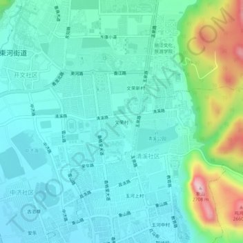
Name: 文荣村 topographic map, elevation, terrain.
Location: 文荣村, 束河街道, 古城区, 丽江市, 云南省, 674100, 中国 (26.88628 100.20138 26.92628 100.24138)
Average elevation: 2,461 m
Minimum elevation: 2,399 m
Maximum elevation: 2,692 m
Other topographic maps
Click on a map to view its topography, its elevation and its terrain.