
Gavi topographic map
Click on the map to display elevation.
About this map
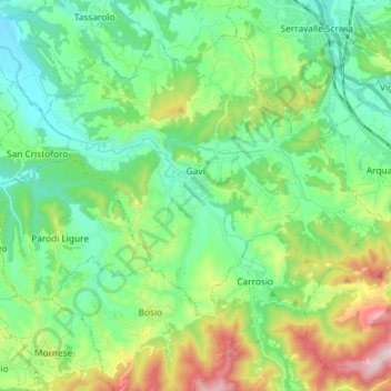
Name: Gavi topographic map, elevation, terrain.
Location: Gavi, Alessandria, Piedmont, 15066, Italy (44.63746 8.74355 44.72461 8.88956)
Average elevation: 306 m
Minimum elevation: 157 m
Maximum elevation: 689 m
Other topographic maps
Click on a map to view its topography, its elevation and its terrain.