
Las Maravillas topographic map
Interactive map
Click on the map to display elevation.
About this map
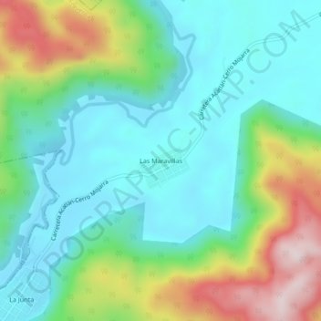
Name: Las Maravillas topographic map, elevation, terrain.
Location: Las Maravillas, Acatlán de Pérez Figueroa, Oaxaca, México (18.48806 -96.65861 18.52806 -96.61861)
Average elevation: 231 m
Minimum elevation: 84 m
Maximum elevation: 590 m
Other topographic maps
Click on a map to view its topography, its elevation and its terrain.
Cañada San Antonio
México > Oaxaca > Acatlán de Pérez Figueroa
Cañada San Antonio, Acatlán de Pérez Figueroa, Oaxaca, México
Average elevation: 139 m
Vicente Camalote
México > Oaxaca > Acatlán de Pérez Figueroa > Vicente Camalote
Vicente Camalote, Acatlán de Pérez Figueroa, Oaxaca, 68422, México
Average elevation: 118 m