
Shkhara topographic map
Interactive map
Click on the map to display elevation.
About this map
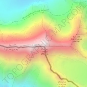
Name: Shkhara topographic map, elevation, terrain.
Location: Shkhara, Mestia Municipality, Samegrelo-Upper Svaneti, Georgia (43.00024 43.11278 43.00034 43.11288)
Average elevation: 4,334 m
Minimum elevation: 3,526 m
Maximum elevation: 5,224 m
Other topographic maps
Click on a map to view its topography, its elevation and its terrain.
Tsaneri Glacier
Georgia > Samegrelo-Upper Svaneti
Tsaneri Glacier, Mestia Municipality, Samegrelo-Upper Svaneti, Georgia
Average elevation: 3,592 m