
Bekkevoort topographic map
Interactive map
Click on the map to display elevation.
About this map
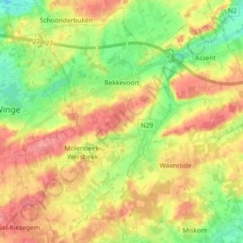
Name: Bekkevoort topographic map, elevation, terrain.
Location: Bekkevoort, Brabant flamand, Flandre, Belgique (50.89289 4.91940 50.96932 5.04531)
Average elevation: 53 m
Minimum elevation: 18 m
Maximum elevation: 86 m