
Ziwi topographic map
Interactive map
Click on the map to display elevation.
About this map
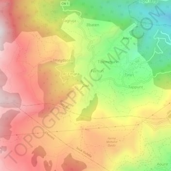
Name: Ziwi topographic map, elevation, terrain.
Location: Ziwi, Akfadou, Daïra Chemini, Béjaïa, 06411, Algérie (36.60623 4.59097 36.64623 4.63097)
Average elevation: 1,012 m
Minimum elevation: 487 m
Maximum elevation: 1,452 m
Other topographic maps
Click on a map to view its topography, its elevation and its terrain.
Tiniri
Algérie > Béjaïa > Daïra Chemini > Akfadou
Tiniri, Akfadou, Daïra Chemini, Béjaïa, 06411, Algérie
Average elevation: 878 m
Mezouara
Algérie > Béjaïa > Daïra Chemini > Akfadou
Mezouara, Akfadou, Daïra Chemini, Béjaïa, 06411, Algérie
Average elevation: 1,078 m