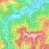
Gesha topographic map
Click on the map to display elevation.
About this map

Name: Gesha topographic map, elevation, terrain.
Location: Gesha, Drianovo, Gabrovo, Bulgaria (42.94772 25.39476 43.00248 25.45283)
Average elevation: 394 m
Minimum elevation: 234 m
Maximum elevation: 643 m
Other topographic maps
Click on a map to view its topography, its elevation and its terrain.