
Thank you for supporting this site ❤️
Make a donation
Make a donation
Fell Foot topographic map
Click on the map to display elevation.
Thank you for supporting this site ❤️
Make a donation
Make a donation
About this map
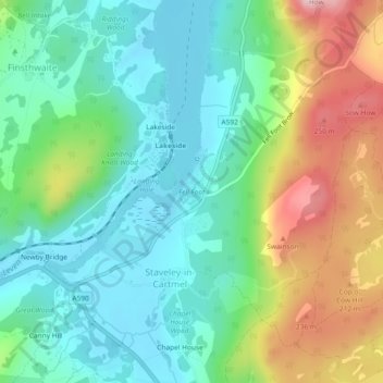
Name: Fell Foot topographic map, elevation, terrain.
Average elevation: 117 m
Minimum elevation: 39 m
Maximum elevation: 285 m
Thank you for supporting this site ❤️
Make a donation
Make a donation
Other topographic maps
Click on a map to view its topography, its elevation and its terrain.
Newby Bridge
United Kingdom > England > Westmorland and Furness > Staveley-in-Cartmel
Average elevation: 109 m
Staveley-in-Cartmel
United Kingdom > England > Westmorland and Furness > Staveley-in-Cartmel
Average elevation: 110 m