
Thank you for supporting this site ❤️
Make a donation
Make a donation
Antares topographic map
Click on the map to display elevation.
Thank you for supporting this site ❤️
Make a donation
Make a donation
About this map
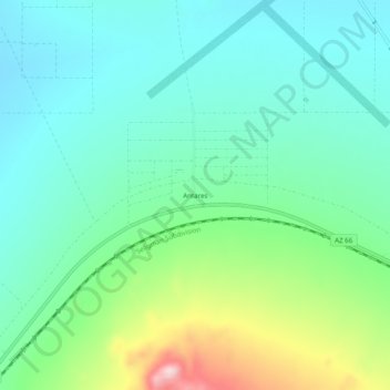
Name: Antares topographic map, elevation, terrain.
Location: Antares, Mohave County, Arizona, United States (35.39972 -113.82856 35.43972 -113.78856)
Average elevation: 1,084 m
Minimum elevation: 1,002 m
Maximum elevation: 1,320 m
Thank you for supporting this site ❤️
Make a donation
Make a donation