
Sarpy County topographic map
Interactive map
Click on the map to display elevation.
About this map
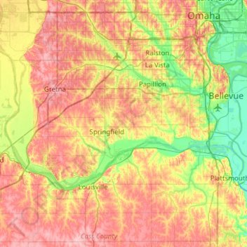
Name: Sarpy County topographic map, elevation, terrain.
Location: Sarpy County, Nebraska, United States (40.99636 -96.33941 41.19127 -95.84162)
Average elevation: 343 m
Minimum elevation: 285 m
Maximum elevation: 406 m
Other topographic maps
Click on a map to view its topography, its elevation and its terrain.
Bellevue
United States > Nebraska > Sarpy County
Bellevue, Sarpy County, Nebraska, United States
Average elevation: 310 m
Springfield
United States > Nebraska > Sarpy County
Springfield, Sarpy County, Nebraska, 68059, United States
Average elevation: 344 m