
Thank you for supporting this site ❤️
Make a donation
Make a donation
Almelo topographic map
Click on the map to display elevation.
Thank you for supporting this site ❤️
Make a donation
Make a donation
About this map
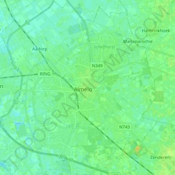
Name: Almelo topographic map, elevation, terrain.
Location: Almelo, Overijssel, Nederland (52.31507 6.59770 52.39912 6.72117)
Average elevation: 12 m
Minimum elevation: 6 m
Maximum elevation: 25 m
Thank you for supporting this site ❤️
Make a donation
Make a donation
Other topographic maps
Click on a map to view its topography, its elevation and its terrain.