
Thank you for supporting this site ❤️
Make a donation
Make a donation
Lanheses topographic map
Click on the map to display elevation.
Thank you for supporting this site ❤️
Make a donation
Make a donation
About this map
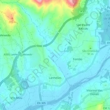
Name: Lanheses topographic map, elevation, terrain.
Location: Lanheses, Viana do Castelo, Portugal (41.72238 -8.71118 41.77662 -8.66436)
Average elevation: 44 m
Minimum elevation: -4 m
Maximum elevation: 307 m
Thank you for supporting this site ❤️
Make a donation
Make a donation
Other topographic maps
Click on a map to view its topography, its elevation and its terrain.