
Make a donation
Sumner Lake State Park topographic map
Click on the map to display elevation.
Make a donation
Sumner Lake State Park
The park features a large 4,500-acre (18 km2) reservoir on the Pecos River, created in 1939 by the Sumner Dam of the United States Bureau of Reclamation. The reservoir is home to various fish species including largemouth bass, catfish, crappie and walleye. The park elevation is 4,300 feet (1,300 m) above sea level. With its campground, expansive views of the sky, and its distance from other cities, Sumner Lake State Park has a low level of light pollution, which makes the state park a great potential place for amateur astronomy.
Make a donation
About this map
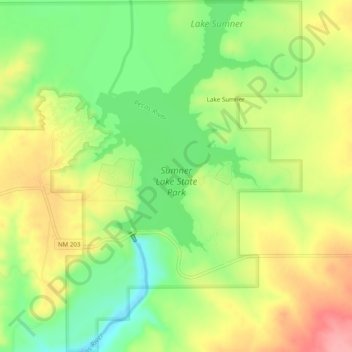
Name: Sumner Lake State Park topographic map, elevation, terrain.
Average elevation: 1,311 m
Minimum elevation: 1,262 m
Maximum elevation: 1,364 m
Make a donation
Other topographic maps
Click on a map to view its topography, its elevation and its terrain.