
Kendari topographic map
Interactive map
Click on the map to display elevation.
About this map
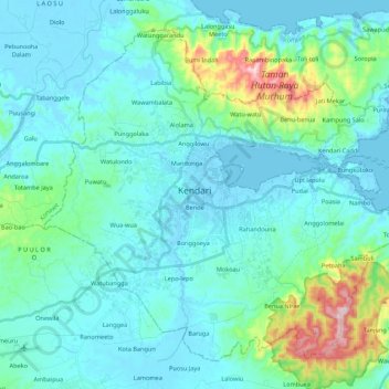
Name: Kendari topographic map, elevation, terrain.
Location: Kendari, Südost-Sulawesi, Indonesien (-4.08434 122.44015 -3.90329 122.65178)
Average elevation: 68 m
Minimum elevation: -3 m
Maximum elevation: 446 m