
Thank you for supporting this site ❤️
Make a donation
Make a donation
Lebanon Township topographic map
Click on the map to display elevation.
Thank you for supporting this site ❤️
Make a donation
Make a donation
About this map
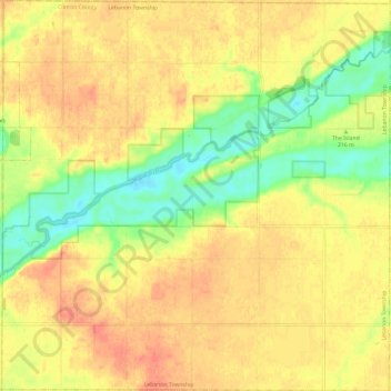
Name: Lebanon Township topographic map, elevation, terrain.
Location: Lebanon Township, Clinton County, Michigan, United States (43.03215 -84.83730 43.11883 -84.71935)
Average elevation: 220 m
Minimum elevation: 191 m
Maximum elevation: 240 m
Thank you for supporting this site ❤️
Make a donation
Make a donation
Other topographic maps
Click on a map to view its topography, its elevation and its terrain.