
Stafford topographic map
Interactive map
Click on the map to display elevation.
About this map
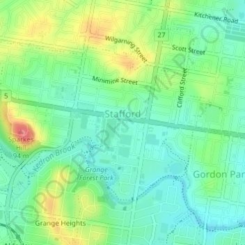
Name: Stafford topographic map, elevation, terrain.
Location: Stafford, 布里斯班, 昆士兰州, 澳大利亚 (-27.41953 152.99756 -27.40160 153.02496)
Average elevation: 39 m
Minimum elevation: 12 m
Maximum elevation: 91 m
Other topographic maps
Click on a map to view its topography, its elevation and its terrain.