
Montabaur topographic map
Interactive map
Click on the map to display elevation.
About this map
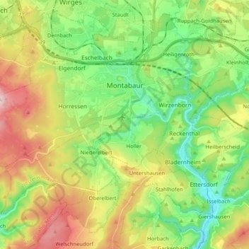
Name: Montabaur topographic map, elevation, terrain.
Location: Montabaur, Westerwaldkreis, Rheinland-Pfalz, 56410, Deutschland (50.38320 7.72773 50.45710 7.88655)
Average elevation: 302 m
Minimum elevation: 154 m
Maximum elevation: 543 m