
Bazemore topographic map
Interactive map
Click on the map to display elevation.
About this map
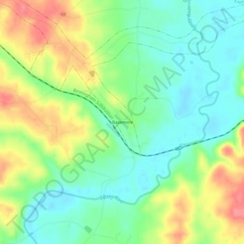
Name: Bazemore topographic map, elevation, terrain.
Location: Bazemore, Fayette County, Alabama, 37794, United States (33.87455 -87.72002 33.91455 -87.68002)
Average elevation: 146 m
Minimum elevation: 115 m
Maximum elevation: 195 m