
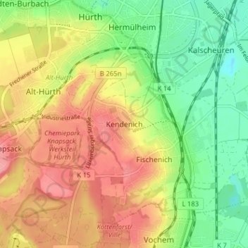
Kendenich topographic map
Interactive map
Click on the map to display elevation.
About this map
Name: Kendenich topographic map, elevation, terrain.
Average elevation: 89 m
Minimum elevation: 44 m
Maximum elevation: 133 m
Other topographic maps
Click on a map to view its topography, its elevation and its terrain.
An der Horbeller Burg
Deutschland > Nordrhein-Westfalen > Rhein-Erft-Kreis > Hürth > Sielsdorf
An der Horbeller Burg, Sielsdorf, Hürth, Rhein-Erft-Kreis, Nordrhein-Westfalen, 50354, Deutschland
Average elevation: 61 m
Knapsack
Deutschland > Nordrhein-Westfalen > Rhein-Erft-Kreis > Hürth
Knapsack, Hürth, Rhein-Erft-Kreis, Nordrhein-Westfalen, 50354, Deutschland
Average elevation: 108 m
Gleuel
Deutschland > Nordrhein-Westfalen > Rhein-Erft-Kreis > Hürth
Gleuel, Hürth, Rhein-Erft-Kreis, Nordrhein-Westfalen, 50354, Deutschland
Average elevation: 81 m
Fischenich
Deutschland > Nordrhein-Westfalen > Rhein-Erft-Kreis > Hürth > Fischenich
Fischenich, Hürth, Rhein-Erft-Kreis, Nordrhein-Westfalen, 50354, Deutschland
Average elevation: 86 m