
Wastines topographic map
Interactive map
Click on the map to display elevation.
About this map
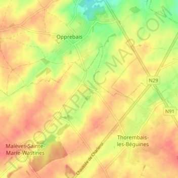
Name: Wastines topographic map, elevation, terrain.
Location: Wastines, Perwijs, Nijvel, Waals-Brabant, Wallonië, 1315, België (50.64997 4.78287 50.68997 4.82287)
Average elevation: 133 m
Minimum elevation: 100 m
Maximum elevation: 152 m
Other topographic maps
Click on a map to view its topography, its elevation and its terrain.
Perwijs
België > Waals-Brabant > Nijvel > Perwijs
Perwijs, Nijvel, Waals-Brabant, Wallonië, 1360, België
Average elevation: 152 m