
Brandou topographic map
Interactive map
Click on the map to display elevation.
About this map
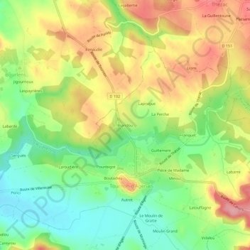
Name: Brandou topographic map, elevation, terrain.
Average elevation: 171 m
Minimum elevation: 108 m
Maximum elevation: 242 m
Other topographic maps
Click on a map to view its topography, its elevation and its terrain.
Boutadieu
France > Nouvelle-Aquitaine > Lot-et-Garonne > Tournon-d'Agenais
Boutadieu, Tournon-d'Agenais, Villeneuve-sur-Lot, Lot-et-Garonne, Nouvelle-Aquitaine, France métropolitaine, 47370, France
Average elevation: 164 m
Franquet
France > Nouvelle-Aquitaine > Lot-et-Garonne > Tournon-d'Agenais
Franquet, Tournon-d'Agenais, Villeneuve-sur-Lot, Lot-et-Garonne, Nouvelle-Aquitaine, France métropolitaine, 47370, France
Average elevation: 183 m