
Le Plan de Phazy topographic map
Interactive map
Click on the map to display elevation.
About this map
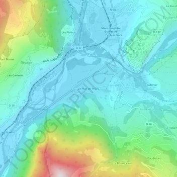
Name: Le Plan de Phazy topographic map, elevation, terrain.
Average elevation: 1,078 m
Minimum elevation: 870 m
Maximum elevation: 1,825 m
Other topographic maps
Click on a map to view its topography, its elevation and its terrain.
Plan de Phazy
France > Provence-Alpes-Côte d'Azur > Hautes-Alpes > Risoul > Le Plan de Phazy
Plan de Phazy, Le Plan de Phazy, Risoul, Briançon, Hautes-Alpes, Provence-Alpes-Côte d'Azur, France métropolitaine, 05600, France
Average elevation: 1,026 m