
Thanthirikanda topographic map
Interactive map
Click on the map to display elevation.
About this map
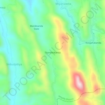
Name: Thanthirikanda topographic map, elevation, terrain.
Average elevation: 254 m
Minimum elevation: 97 m
Maximum elevation: 571 m
Other topographic maps
Click on a map to view its topography, its elevation and its terrain.
Bopath Ella
Sri Lanka > Sabaragamuwa Province > Thanthirikanda
Bopath Ella, Higgashena-Devipahala Road, Thanthirikanda, Ratnapura District, Sabaragamuwa Province, Sri Lanka
Average elevation: 118 m