
Make a donation
Scopello topographic map
Click on the map to display elevation.
Make a donation
Scopello
Scopello is a comune (municipality) located in the Valsesia region of the Italian Pennine Alps, administratively in the Province of Vercelli, Piedmont. The municipality covers an area of 18.62 square kilometres (7.19 sq mi) and ranges in elevation from 640 to 1,930 metres (2,100 to 6,330 ft) above sea level. It takes its name from its main centre, the small town of Scopello, which stands on the river Sesia at an elevation of 659 metres (2,162 ft).
Make a donation
About this map
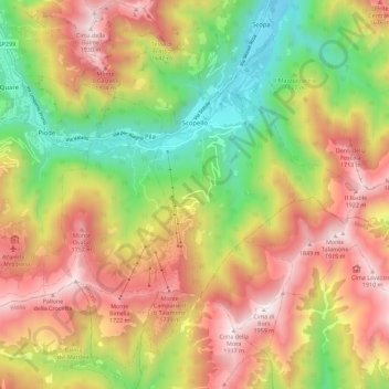
Name: Scopello topographic map, elevation, terrain.
Location: Scopello, Vercelli, Piedmont, 13028, Italy (45.71875 8.05898 45.79749 8.14081)
Average elevation: 1,256 m
Minimum elevation: 595 m
Maximum elevation: 1,935 m
Make a donation
Other topographic maps
Click on a map to view its topography, its elevation and its terrain.
Make a donation
Make a donation