
Gößnitz topographic map
Interactive map
Click on the map to display elevation.
About this map
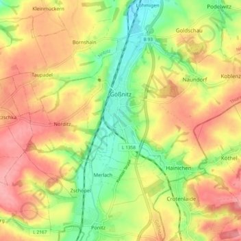
Name: Gößnitz topographic map, elevation, terrain.
Location: Gößnitz, Altenburger Land, Thüringen, 04639, Deutschland (50.86210 12.39611 50.90323 12.48819)
Average elevation: 248 m
Minimum elevation: 198 m
Maximum elevation: 292 m