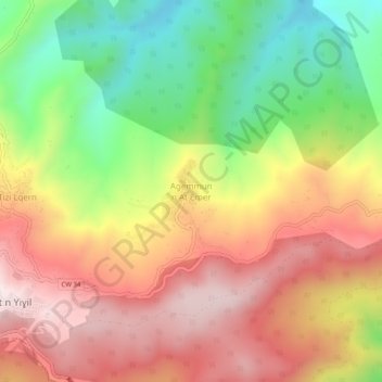
Aguemoune n'Ath Amar topographic map
Interactive map
Click on the map to display elevation.
About this map
Name: Aguemoune n'Ath Amar topographic map, elevation, terrain.
Average elevation: 691 m
Minimum elevation: 347 m
Maximum elevation: 1,005 m

Click on the map to display elevation.
Name: Aguemoune n'Ath Amar topographic map, elevation, terrain.
Average elevation: 691 m
Minimum elevation: 347 m
Maximum elevation: 1,005 m