
店埠镇 topographic map
Interactive map
Click on the map to display elevation.
About this map
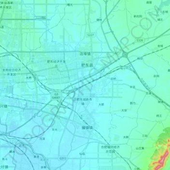
Name: 店埠镇 topographic map, elevation, terrain.
Location: 店埠镇, 肥东县, 合肥市, 安徽省, 231600, 中国 (31.78027 117.42537 31.93807 117.63137)
Average elevation: 27 m
Minimum elevation: 5 m
Maximum elevation: 277 m
Other topographic maps
Click on a map to view its topography, its elevation and its terrain.