

Make a donation
Limousin topographic map
Click on the map to display elevation.
Make a donation
About this map

Name: Limousin topographic map, elevation, terrain.
Location: Limousin, Metropolitan France, France (43.11754 -0.85931 48.31754 4.34069)
Average elevation: 257 m
Minimum elevation: -3 m
Maximum elevation: 1,773 m
Make a donation
Other topographic maps
Click on a map to view its topography, its elevation and its terrain.
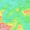
Paris
France > Ile-de-France > Paris
Paris in its early history had only the rivers Seine and Bièvre for water. From 1809, the Canal de l'Ourcq provided Paris with water from less-polluted rivers to the north-east of the capital. From 1857, the civil engineer Eugène Belgrand, under Napoleon III, oversaw the construction of a series of new…
Average elevation: 62 m
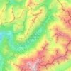
Chamonix-Mont-Blanc
France > Auvergne-Rhône-Alpes > Upper Savoy
Due to its elevation, Chamonix has a humid continental climate (Dfb, according to the Köppen climate classification), with an average annual precipitation of 1,280 mm (50 in). Summers are mild and winters are cold and snowy.
Average elevation: 2,215 m
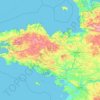
Brittany
France > Brittany > Landerneau > Loudéac
The Armorican massif reaches its maximal elevation outside of Brittany, in neighbouring Mayenne, at 417 m, and slopes towards the west before straightening on its western extremity, with the Montagnes Noires and the Monts d'Arrée. The highest hill in Brittany is the Roc'h Ruz in the Monts d'Arrée, at 385 m…
Average elevation: 50 m
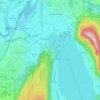
Annecy
France > Auvergne-Rhône-Alpes > Annecy
Annecy has an oceanic climate (Köppen Cfb) in spite of its relatively far inland position. Influenced by its elevation, summers are rather moderate on average, although they can be highly variable with extreme heat spikes. Winters see occasional freezing temperatures, but most often stays in the single-digits…
Average elevation: 554 m
Make a donation

Kerguelen Island
France > French Southern and Antarctic Lands
The highest point is Mont Ross in the Gallieni Massif, which rises along the southern coast of the island and has an elevation of 1,850 metres (6,070 ft). The Cook Ice Cap (French: Calotte Glaciaire Cook), France's largest glacier with an area of about 403 km2 (156 sq mi), lies on the west-central part of the…
Average elevation: 45 m
Make a donation
Ardennes
Covering 5,229 square kilometres (2,019 square miles), the department was the smallest among the four contributors to Champagne-Ardenne. It is diverse in climate, topography, natural vegetation and land use, which is a mixture of forest and arable farming.
Average elevation: 225 m
Saint Barthélemy
Morne de Vitet, 286 metres (938 feet) in height, is the highest peak on the island. Hills and valleys of varying topography cover the rest of the island. Notable are Morne Rouge, Morne Criquet, Morne de Grand Fond, Morne de Dépoudré and Morne Lurin. The largest bodies of water on the island are Étang de…
Average elevation: 4 m
Make a donation
Corsica
Under the Köppen climate classification scheme, coastal regions are characterized by a hot-summer Mediterranean climate (Csa). Further inland, a warm-summer Mediterranean climate (Csb) is more common. At the highest elevation locations, small areas with a subarctic climate (Dsc, Dfc) and the rare cold-summer…
Average elevation: 139 m
Grenoble
France > Auvergne-Rhône-Alpes > Isère
Except for a few dozen houses on the slopes of the Bastille hill of Chartreuse, Grenoble is exclusively built on the alluvial plain of the rivers Isère and Drac at an altitude of 214 metres (702 ft). As a result, the city itself is extremely flat. Mountain sports are an important tourist attraction in summer…
Average elevation: 246 m
Make a donation
Saint-Étienne
France > Auvergne-Rhône-Alpes > Loire
The climate is temperate at the weather station due to its low altitude, but Saint-Étienne itself is much higher, above 530 m (1,739 ft) in the centre, as well as even above 700 m (2,297 ft) in the southern parts of the city. Saint-Étienne is very close to a warm-summer humid continental climate (Köppen:…
Average elevation: 669 m

Make a donation
Paris
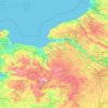
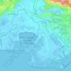
Paris is situated on a relatively flat terrain, with its average elevation around 150 feet (45 meters) above sea level. The city lies within the Paris Basin, a low-lying area that was shaped over millennia by the meandering River Seine, which cuts through the city. Though generally flat, Paris is home to…
Average elevation: 59 m
Les Houches
France > Auvergne-Rhône-Alpes > Upper Savoy
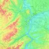
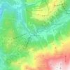
Les Houches, located 6 kilometres from Chamonix, is a ski resort with a domain which extends from an altitude of 950 metres up to 1900 metres. Long descents through tree-lined slopes are combined with impressive views of the Mont Blanc massif and the Chamonix valley.
Average elevation: 1,728 m
Massif Central
The Massif Central is an old massif, formed during the Variscan orogeny, consisting mostly of granitic and metamorphic rocks. It was powerfully raised and made to look geologically younger in the eastern section by the uplift of the Alps during the Paleogene period and in the southern section by the uplift of…
Average elevation: 371 m
Make a donation

Make a donation

Make a donation

Bora-Bora
France > French Polynesia > Bora-Bora
The bay of Tuuraapuo was the main crater of the volcano, whose collapsed southwestern edge only subsists still in the islets Toopua and Toopua-iti, which culminate respectively at 148 m (486 ft) and 17 m (56 ft), altitude. The volcanic rocks are of basaltic type, consisting mostly of alkaline basalts, some…
Average elevation: 11 m

Make a donation

Make a donation
Paris
France > Ile-de-France > Paris
Paris in its early history had only the rivers Seine and Bièvre for water. From 1809, the Canal de l'Ourcq provided Paris with water from less-polluted rivers to the north-east of the capital. From 1857, the civil engineer Eugène Belgrand, under Napoleon III, oversaw the construction of a series of new…
Average elevation: 62 m

Make a donation


Make a donation


Make a donation

Make a donation

L'Aiguillon-sur-Mer
France > Pays de la Loire > Vendée > L'Aiguillon-la-Presqu'île
Average elevation: 1 m
Make a donation
Mer de Glace
France > Auvergne-Rhône-Alpes > Upper Savoy > Chamonix-Mont-Blanc
The glacier lies above the Chamonix valley. The pressure within the ice is known to reach at least 30 atmospheres. The Mer de Glace can be considered as originating at an elevation of 2,100 metres (6,900 ft), just north of the Aiguille du Tacul, where it is formed by the confluence of the Glacier de Leschaux…
Average elevation: 2,323 m
Make a donation



Make a donation
Bora-Bora
France > French Polynesia > Bora-Bora
The bay of Tuuraapuo was the main crater of the volcano, whose collapsed southwestern edge only subsists still in the islets Toopua and Toopua-iti, which culminate respectively at 148 m (486 ft) and 17 m (56 ft), altitude. The volcanic rocks are of basaltic type, consisting mostly of alkaline basalts, some…
Average elevation: 11 m
Toulouse
France > Occitania > Haute-Garonne
The first half of the 14th century was a prosperous period, despite the dismemberment in 1317 of the very large bishopric of Toulouse (which lost two thirds of its area and a large part of its income, a loss only partially compensated by its elevation to the rank of archbishopric), and the episode of the…
Average elevation: 155 m
Make a donation


Make a donation
Beaufou
France > Pays de la Loire > Vendée
The municipal territory of Beaufou covers 2,798 hectares. The average altitude of the municipality is 62 meters, with height fluctuating between 28 and 74 meters.
Average elevation: 59 m
Make a donation
Ile-de-France
The River Seine flows through the middle of the region, which is crisscrossed by its tributaries and sub-tributaries, including the Rivers Marne, Oise and Epte. The River Eure does not cross the region but receives water from several rivers in the Île-de-France, including the Drouette and the Vesgre. The…
Average elevation: 124 m

Make a donation
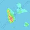
Guadeloupe
The main two islands are Basse-Terre (west) and Grande-Terre (east), which form a butterfly shape as viewed from above, the two 'wings' of which are separated by the Grand Cul-de-Sac Marin, Rivière Salée and Petit Cul-de-Sac Marin. More than half of Guadeloupe's land surface consists of the 847.8 km2…
Average elevation: 37 m
Make a donation
Nantes
France > Pays de la Loire > Loire-Atlantique
Nantes is built on the Armorican Massif, a range of weathered mountains which may be considered the backbone of Brittany. The mountains, stretching from the end of the Breton peninsula to the outskirts of the sedimentary Paris Basin, are composed of several parallel ridges of Ordovician and Cadomian rocks.…
Average elevation: 26 m

Make a donation
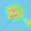
Bora-Bora
France > French Polynesia > Bora-Bora
The bay of Tuuraapuo was the main crater of the volcano, whose collapsed southwestern edge only subsists still in the islets Toopua and Toopua-iti, which culminate respectively at 148 m (486 ft) and 17 m (56 ft), altitude. The volcanic rocks are of basaltic type, consisting mostly of alkaline basalts, some…
Average elevation: 11 m
Make a donation
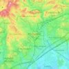
Montpellier
Montpellier's highest point is the Place du Peyrou, at an altitude of 57 m (187 ft). The city is built on two hills, Montpellier and Montpelliéret, thus some of its streets have great differences of altitude. Some of its streets are also very narrow and old, which gives it a more intimate feel.
Average elevation: 41 m
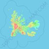
Kerguelen Archipelago
France > French Southern and Antarctic Lands
The highest point is Mont Ross in the Gallieni Massif, which rises along the southern coast of the island and has an elevation of 1,850 metres (6,070 ft). The Cook Ice Cap (French: Calotte Glaciaire Cook), France's largest glacier with an area of about 403 km2 (156 sq mi), lies on the west-central part of the…
Average elevation: 38 m
Make a donation