
Hohe Wurzel topographic map
Interactive map
Click on the map to display elevation.
About this map
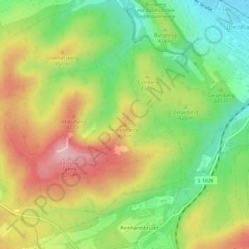
Name: Hohe Wurzel topographic map, elevation, terrain.
Average elevation: 417 m
Minimum elevation: 332 m
Maximum elevation: 514 m
Other topographic maps
Click on a map to view its topography, its elevation and its terrain.
Langenhain
Deutschland > Thüringen > Landkreis Gotha > Waltershausen > Langenhain
Langenhain, Waltershausen, Landkreis Gotha, Thüringen, 99880, Deutschland
Average elevation: 368 m