
Dachau topographic map
Interactive map
Click on the map to display elevation.
About this map
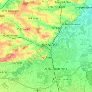
Name: Dachau topographic map, elevation, terrain.
Location: Dachau, Landkreis Dachau, Bavière, 85221, Allemagne (48.22750 11.38439 48.31171 11.50253)
Average elevation: 490 m
Minimum elevation: 462 m
Maximum elevation: 538 m
Other topographic maps
Click on a map to view its topography, its elevation and its terrain.
Haimhausen
Allemagne > Bavière > Landkreis Dachau
Haimhausen, Landkreis Dachau, Bavière, 85778, Allemagne
Average elevation: 475 m