
Haut-Katanga topographic map
Interactive map
Click on the map to display elevation.
About this map
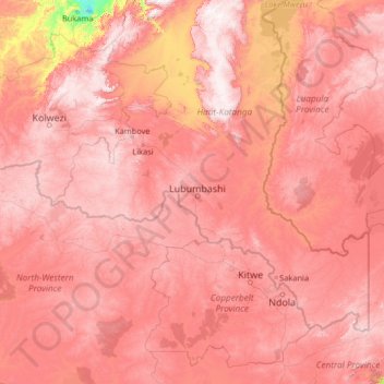
Name: Haut-Katanga topographic map, elevation, terrain.
Location: Haut-Katanga, Democratic Republic of the Congo (-14.20474 24.81319 -9.00474 30.01319)
Average elevation: 1,216 m
Minimum elevation: 570 m
Maximum elevation: 1,818 m
Other topographic maps
Click on a map to view its topography, its elevation and its terrain.