
Flevolanda topographic map
Interactive map
Click on the map to display elevation.
About this map
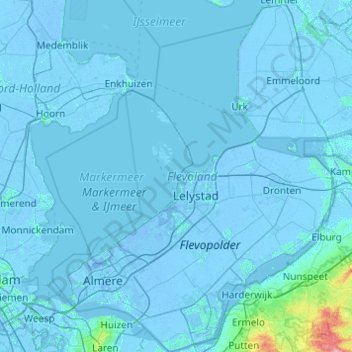
Name: Flevolanda topographic map, elevation, terrain.
Location: Flevolanda, Países Bajos (52.24953 5.06043 52.84398 6.01730)
Average elevation: 1 m
Minimum elevation: -9 m
Maximum elevation: 96 m