
Llançà topographic map
Interactive map
Click on the map to display elevation.
About this map
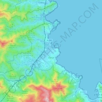
Name: Llançà topographic map, elevation, terrain.
Location: Llançà, Oberampurien, Girona, Katalonien, Spanien (42.34061 3.07682 42.39784 3.17477)
Average elevation: 78 m
Minimum elevation: -1 m
Maximum elevation: 503 m