
Thank you for supporting this site ❤️
Make a donation
Make a donation
Vale de Ferro topographic map
Click on the map to display elevation.
Thank you for supporting this site ❤️
Make a donation
Make a donation
About this map
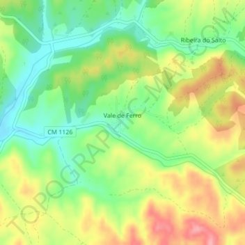
Name: Vale de Ferro topographic map, elevation, terrain.
Location: Vale de Ferro, Relíquias, Odemira, Beja, Portugal (37.68093 -8.55428 37.68923 -8.54498)
Average elevation: 132 m
Minimum elevation: 82 m
Maximum elevation: 194 m
Thank you for supporting this site ❤️
Make a donation
Make a donation
Other topographic maps
Click on a map to view its topography, its elevation and its terrain.